Still no sun. Daylight from about 11:30am to 4:30pm.
This week's story: Driving the Ice Road from Inuvik to Tuktoyaktuk!
Yesterday we rented a white beast of a Chevvy Suburban from a local car rental agency, and took it for a spin out on the Ice Road on the Mackenzie River. (Not literally, we were very safe drivers!) It's a 187km drive from Inuvik to Tuktoyaktuk, and takes about 3 hours each way. Which may sound a bit tedious for a day-trip, but I'd like to point out that Frommer's, the travel blog, does actually recommend this trip as one of the "Best things to do in Canada!" http://www.frommers.com/micro/2011/the-very-best-of-canada/drive-the-ice-road-from-inuvik-to-tuktoyaktuk.html
They list 12 activities by month: this is the 'March' recommended activity, when there is considerably more light and less negatives on the thermometer than the dying end of December. And this blog entry does have an interesting way of selling the trip, telling you to "enjoy the bleak surroundings that seem to go on forever." (That's usually not a good thing?!)
Regardless, we somehow decided this was a good idea. And given the time of year, we were lucky to have a clear day with no blowing snow, allowing us to make it up and back safely. The temperature was only a mild deterrent to getting out of the truck - we came back with over 100 photos on our camera, proving we did brave the fresh outdoor air! Don't worry, I won't post them all. But here are a select few to help tell the story:
We left just before 'dawn', and headed up-river.
As the sun 'rose' towards the horizon, the sky turned amazingly orange in the south, and stayed that way for the next 4 hours!
The sky is still orange, but now we've left the trees behind.
Facing north, the sky was more purple and pink.
The ice had frozen quite clear at some points on the road, and we got out to take a closer look. It was a little like walking on the glass floor of the CN tower. Not the most comforting feeling!
After 3 hours of driving, we finally reached the town of Tuktoyaktuk, or 'Tuk' - those tiny specs of houses on the horizon there. To the right is tundra, (very flat treeless snow-covered land), and to the left is the Beaufort Sea, part of the Arctic Ocean (very flat treeless snow-covered ice). You couldn't see the sea ice edge in the ocean, it was white far into the horizon.
Tuk is a town of just under a thousand people, the largest community north of Inuvik. It is traditionally an Inuvialuit whaling camp, although the people also hunt land animals such as Caribou. The name 'Tuktoyaktuk' means "looks like a caribou" in Inuvialuktun. It is known for having a unique community freezer dug over 30 feet into the Permafrost, and we managed to find someone with a key for it to let us down to take a look!
The entrance was essentially a little outhouse-style shed, with a trap door in the floor. A ladder reached down the 3x3ft shaft of the Community Freezer. This photo is actually from the bottom looking back up.
Descending the ladder! It was dark and smelled like we were heading into a fish market with no ventilation. Which, I guess in a way we were. People traditionally used the freezer to store their fish and game harvest when times were good, and it would be shared with the other families or stored for times of hunger. Being below the permafrost, things stay frozen all year round, preserving the meat even in the summer.
Reaching the bottom, 30 feet underground, we found a network of three hallways, each about 5 feet high and 4 feet wide, with 19 little rooms with wooden doors carved into the sides of the tunnel walls. It was dark, but our headlamps provided more than enough light to look around. And it was actually much warmer down below the ground than outside!
The walls of the tunnels were fascinating - you can see the beautiful horizontal striations formed by the mud and ice of the permafrost. I was surprised - it all seemed to be made of frozen water more than actual dirt! The upper walls and ceiling were covered in crystals, which just shimmered in the light. It was incredible. Well worth the drive for that alone.
The only other thing to do in Tuk was to stop by the health centre of course! Neither of us have done a doctors clinic there yet, although we have a loose promise that we may both get to go up for the clinic later in January. We got a tour from the friendly nurse on call there, who is from New Zealand! We had spoken to her about patients on the phone many times, and it was nice to finally meet her and see the centre.
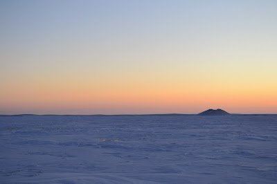
One more 'tourist' landmark of Tuktoyaktuk is to go see the Pingos. Pingos are large hills rising out of the flat tundra, formed by water flowing below the permafrost in old lake beds, freezing and thereby lifting the land up each winter. Apparently the largest Pingo is 16 stories high, and growing at a rate of 2cm a year. We decided it was a little to cold to hike a Pingo, but took photos from afar.
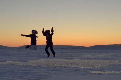
And of course, our friend Sarah (a med student here) and I had to take the obligatory 'jumping-in-the-sunset' photo!
As the sun set, we headed back to our beautiful beast of a Suburban, and down the Ice road, this time in the dark! I couldn't help thinking - if you spun around on the ice road in the dark, you would have no idea which way to start driving again. Things look the same on both sides of the road! Thank God, there was no spinning, and we arrived safely back to Inuvik before 7pm. The only damage was a tiny speck of red peeling frostbite I discovered on the tip of my nose this morning!
Back to work tomorrow...
 |
| Fun Fact: Season 2 of "Ice Road Truckers", the History Channel reality show about truck drivers in Northern Canada and Alaska, took place on this Ice Road between Inuvik and Tuktoyaktuk. |


WOW!
ReplyDeleteWe are waiting for a guest post coming soon... :-)
ReplyDelete